
2024-2027: COASTLINE Project
COASTLINE: Coastal Zone Environment and Geo-Sciences
Department of Civil Engineering and Geoinformatics of Cyprus University of Technology (HORIZON-MSCA-2022-SE-01, €634,800).

Description:
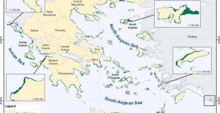
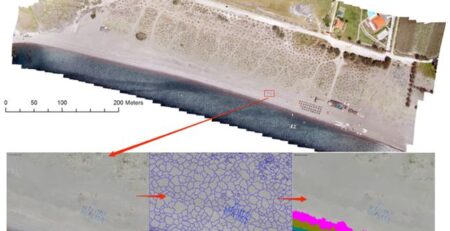
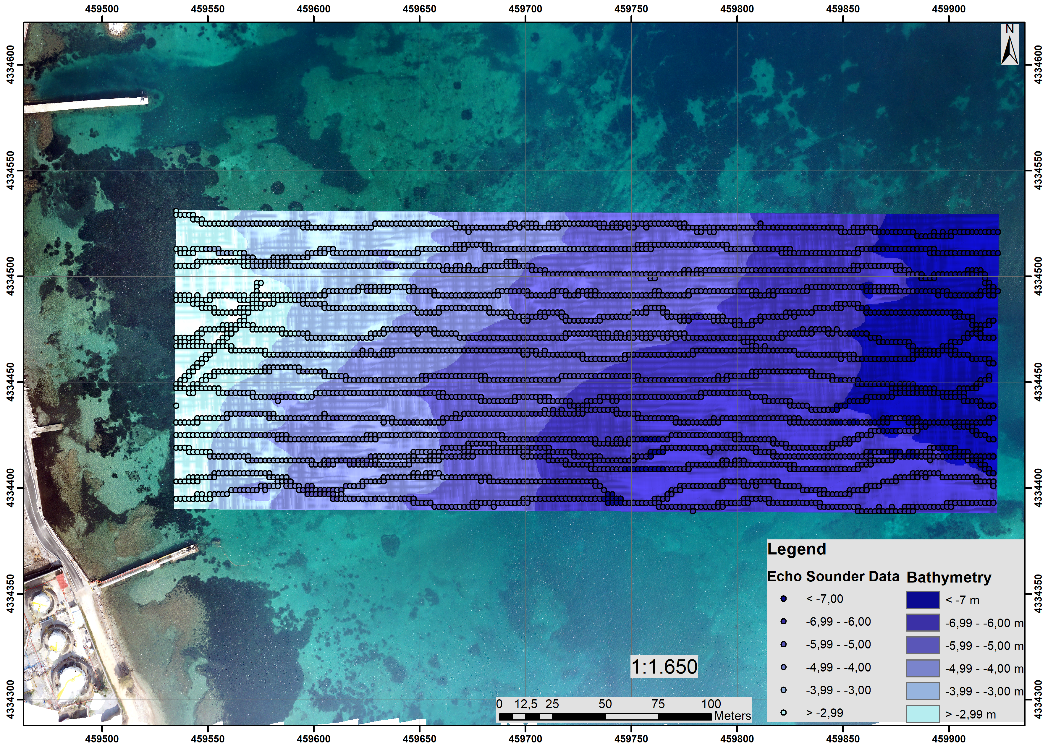
Coastal zones can be characterized as biodiversity-rich ecosystems and places rich in cultural heritage. They host important economic modern activities either inland or in water, providing opportunities for the generation of renewable energies and tourism. For Europe, the coastal regions are tremendously significant for its economy, as approximately 40% of the EU’s population lives within 50 km of the sea, while almost 40% of the EU’s GDP is generated in these maritime regions, and a staggering 75% of the volume of the EU’s foreign trade is conducted by sea. However, the natural dynamic landscape of the coastal zones and the complexity of interests make many local communities vulnerable to hazards, including the effects of climate change. These factors create a unique, constantly evolving, and challenging environment, sharing elements from deep-water investigations and dry land surveys. Therefore, novel methodologies have to be developed to map and monitor these areas and adjusted for operational use to the specific conditions and socio-economic environment of each case study. The COASTLINE project aspires to promote innovative international, inter-sectoral, and interdisciplinary collaboration in research and innovation aspects dealing with monitoring coastal zone environments through geoscience and remote sensors. It aims to establish new and improved methods and protocols for documenting and analyzing the coastal zones in selected case studies (coastal zones) of Europe. It will bring together partners from the academia /research institutions with the business sector to share knowledge, ideas, and infrastructures for delivering novel methodologies regarding the use of remote sensors, such as satellite observations (including the Copernicus Programme with the Sentinels’ mission), ground geophysical prospections and Geographical Information Systems along with spatial statistics.
Research Coordinator: Ass. Prof. Apostolos Papakonstantinou (Cyprus University of Technology).
Partners: TECHNOLOGIKO PANEPISTIMIO KYPROU, IDRYMA TECHNOLOGIAS KAI EREVNAS, POLITECNICO DI BARI, P. SOTIROPOULOS-SP. MAROULAKIS G.P., AIGAIOU SOLUTIONS SYMVOULOI KENOTOMIKON EFARMOGON KAI NEON TECHNOLOGION ANONYMI ETAIREIA, GRAFEMA SRL
Funding: HORIZON-MSCA-2022-SE-01, €634,800.
![]()
![]()