
2024-2025: DEPLOYED Project
DEPLOYED: Detection of archaeological proxies using low altitude systems and pedological studies
Department of Civil Engineering and Geoinformatics of Cyprus University...2024-2027: ORIENTATE Project
ORIENTATE: DrOne sensors and immeRsive tEchNologies towards the Thematic MApping of SpaTiotemporal PhEnomena
Department of Civil Engineering and Geoinformatics of Cyprus...2024-2027: COASTLINE Project
COASTLINE: Coastal Zone Environment and Geo-Sciences
Department of Civil Engineering and Geoinformatics of Cyprus University of Technology (HORIZON-MSCA-2022-SE-01,...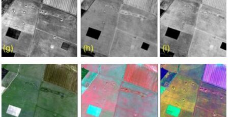
2024-2026: CONNECTING Project
CONNECTING: Research and Innovation Knowledge Centre for Engineering in Heritage
Department of Civil Engineering and Geoinformatics of Cyprus University of Technology...
2023-2026: ARGUS Project
ARGUS: Non-destructive, scalable, smart monitoring of remote cultural treasures
Department of Civil Engineering and Geoinformatics of Cyprus University of Technology (HORIZON-CL2-2023-HERITAGE-01,...
2023-2025: LC3 Project
LC3: Lemesos City Cooling Challenge
Department of Civil Engineering and Geoinformatics of Cyprus University of Technology (NetZeroCities Pilot Cities Programme, NZC-H2020-202209,€1,500,000). ...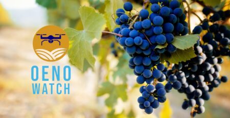
2022-2024 Oenowatch Project
Implementation of a Decision Support System using unmanned aerial systems (UAS) and establishment of a Competence Centre for innovative vine-growing...
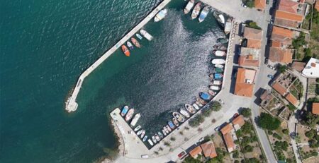
High Precision Survey of Ports
The constant technological evolution in Computer Vision and Unmanned Aerial Vehicles (UAVs), as well as the miniaturization of sensors, may...
Marine Spatial Planning
Cross-border Cooperation for Maritime Spatial Planning Development (Thal-Chor in Greek)
The strategic project “Cross-border Cooperation for Maritime Spatial Planning Development” was...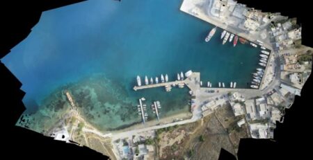
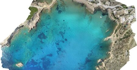
Costal Mapping
Developing methods and processes for data acquisition and mapping of the coastal environment.
Over the last decade, spatial analysis of satellite...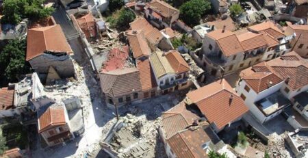
3D Mapping after earthquake
3D Mapping of the Vrissa region affected by the earthquake of Lesvos on 12/06/2017 Following the devastating earthquake of June...
ARSx2 (AeRial System & Anti piRacy System)
In the framework of the Operational Programme Competitiveness, Entrepreneurship, and Innovation, participation in the scientific group for developing the project...
Participation in AMOS project
Geospatial Enabling Technologies (GET) in cooperation with the French SME SEMANTIC TS successfully completed between 5 and 10 of July...
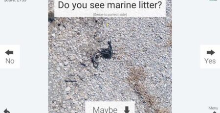
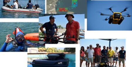
Collaboration with the IIASA team for marine litter tile sorting
The team has performed extensive surveys on coastal environments in Greece, gathering valuable information about marine plastic pollution using drones....
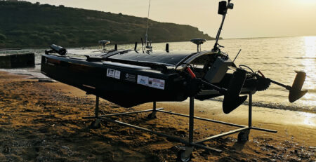
ARGO Hellenic USV
In the framework of the Operational Programme Competitiveness, Entrepreneurship, and Innovation, participation in the scientific group for developing the project...
SPOTS Experiment
Summary
The SPOTS project will take a closer look at the influence of biofouling and water depth on the spectral reflectance...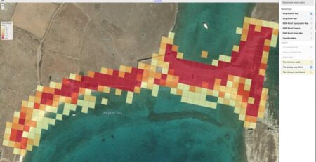
Marine Litter mapping in Rineia island
Rineia: An important archeological site in the center of environmental monitoring for plastic litter pollution. In collaboration with Athanasios K....
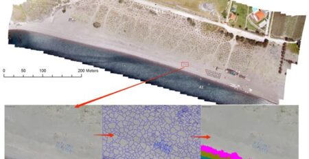
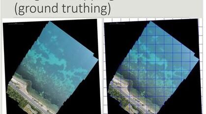
COASTAL Mapping in Lesvos Island
Researchers have developed specific methodologies for identifying coastline and coastal zones (coastal morphology). The availability of very high-resolution digital surface...
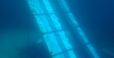
Seagrass mapping
The Common Fisheries Policy of EU requires mapping highly important habitats for fish production (e.g. underwater flowering meadows) in all...
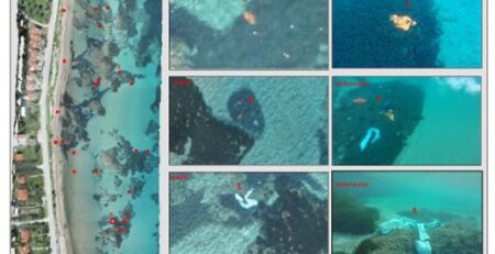
Marine Litter Detection
Preliminary study on the emerging marine litter problem along the eastern coast of Lesbos
The objectives of this preliminary study were...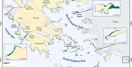
Seagrass mapping in Greek territorial waters using Landat-8 satellite images
Seagrass meadows are among the most valuable coastal ecosystems on earth due to their structural and functional roles in the...