2024-2027: ORIENTATE Project
ORIENTATE: DrOne sensors and immeRsive tEchNologies towards the Thematic MApping of SpaTiotemporal PhEnomena
Department of Civil Engineering and Geoinformatics of Cyprus University of Technology (€39,970).
Description:
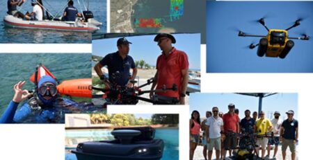
This project, titled “DrOne sensors and immeRsive tEchNologies towards the Thematic MApping of SpaTiotemporal PhEnomena” (ORIENTATE), aims to leverage advancements in UAV (Unmanned Aerial Vehicles) technology combined with Virtual Reality (VR) and Augmented Reality (AR) for enhanced mapping and monitoring of spatiotemporal phenomena. ORIENTATE focuses on the precision and capabilities of modern UAV sensors, including high-resolution cameras and LiDAR systems, to collect detailed spatiotemporal data. Integrating VR and AR technologies, the project seeks to transform data interpretation and decision-making by creating immersive 3D visualizations. The methodology involves UAV data acquisition, preprocessing, and integration into VR/AR platforms to facilitate interactive and intuitive exploration of environmental changes. The goal is to improve user interaction with 3D geovisualizations and enhance the understanding and management of dynamic environmental processes. The project aims to contribute to the evolving field of UAV-based spatiotemporal mapping and offer practical insights for researchers and professionals in various domains.
Research Coordinator: Ass. Prof. Apostolos Papakonstantinou (Cyprus University of Technology).
Funding: ΣΕΕΚ ΤΕΠΑΚ, €39,970.


