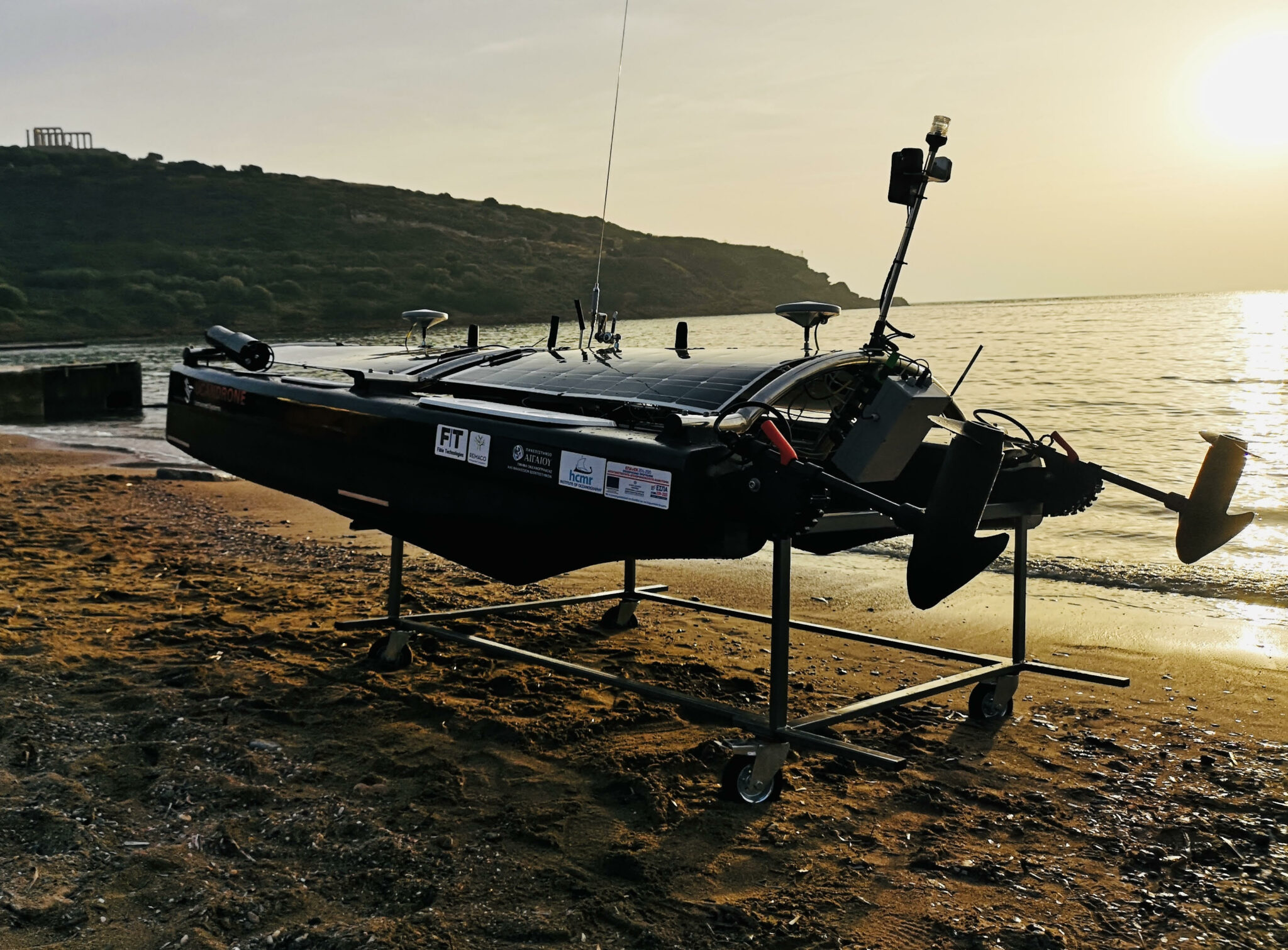

ARGO Hellenic USV
In the framework of the Operational Programme Competitiveness, Entrepreneurship, and Innovation, participation in the scientific group for developing the project “ARGO Hellenic USV‘
Project framework
This research project refers to a partnership of 4 Businesses and 2 Research Institutes with the ultimate goal of bringing together the experience and knowledge of the participant organizations in the provision of research into the collection and analysis of data and information related to the aquatic environment.
The research project refers to industrial research actions for the protection of the marine environment, aiming at the development of viable and economical solutions to the problem of monitoring the aquatic environment and fully identifying the needs of the «blue economy» for sustainable and sustainable development.
The conventional methods of monitoring, recording, and collecting data using specially equipped
Oceanographic vessels or shipboard vessels with diving, sampling, and/or static measuring stations are limited and have significant deficiencies, such as their inability to operate under extreme weather conditions and especially their extremely high manning and maintenance costs.
About the project
The present research project focuses on the development of an integrated unmanned floating surface system with important technological innovations in order to find reliable and economically viable alternatives to the problem of collecting dependable, fast, easily accessible data concerning the aquatic environment.
The system to be developed has customized “smart systems” of data capture and reading based on the combined use of sensors and terrestrial control systems to be remotely operated and managed.

The system presents remarkable innovations in the following areas:
- the on-board / real-time data processing/analysis capabilities
- an energy-independent and environmentally friendly platform (craft) entirely made of the latest aeronautical materials,
- the development of advanced technology sensors (Photogrammetric and radiometric footprint, as well as its connection with pollutants, indicators, and inertial sensors) and
- the information management software, which is the greatest innovation of the system, as
for the first time, it introduces and imprints spatially the environmental variables recorded by its sensors, thus making it possible to manage data from Geographical Systems Information (GIS) from local or remote users.

The proposed research project using “smart” unmanned floating systems aims to develop new methods for monitoring, recording, collecting, and analyzing data from the aquatic environment, with the main advantages of:
- the cost reduction – avoidance of purchase or rental of large conventional vessels per survey, or the development of large scale cost-ineffective networks of fixed measurement stations,
- the rational allocation of resources and the utilization of human resources,
- the capability of real-time monitoring,
- the expansion in the scope of the academic interdisciplinarity and
- the directness of communication lines among the participants of academic / and the private sector.
Participants
For the successful implementation of the project will participate four companies from the private sector, UCANDRONE with vast expertise in Unmanned technologies and remote sensing; AMBIO, with experience in the field of Aquaculture and Fisheries, Marine Spatial Planning and Marine Economy in general, FIBLE with many years of professional and research experience in the IT sector, REMACO SA Business Consulting Company and two research teams from two major Research Institutes of the country, the Aegean University (Department of Marine Sciences) and the Hellenic Center for Marine Research (Institute of Oceanography).