Marine Litter mapping in Rineia island
Rineia: An important archeological site in the center of environmental monitoring for plastic litter pollution. In collaboration with Athanasios K. Laskaridis Foundation, SciDrones, and GET.
The Athanasios K. Laskaridis Foundation and the Department of Marine Sciences of the University of the Aegean join forces to monitor the timeless plastic litter pollution in a place of great archaeological and environmental significance in Greece, the island of Rineia. Rineia, an uninhabited island located near Mykonos and Delos, has 43 km of coastline. It functioned as a place of birth and burial of the inhabitants of Delos, and during the first years of the Peloponnesian War (426/425 BC), it was transformed into a necropolis when the Athenians imposed the purge on the island of Delos. It has a natural harbor and multiple bays that make Rineia an ideal place for environmental monitoring of plastic litter pollution.
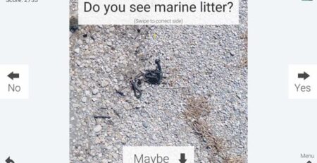
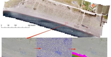
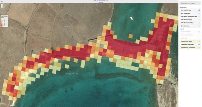
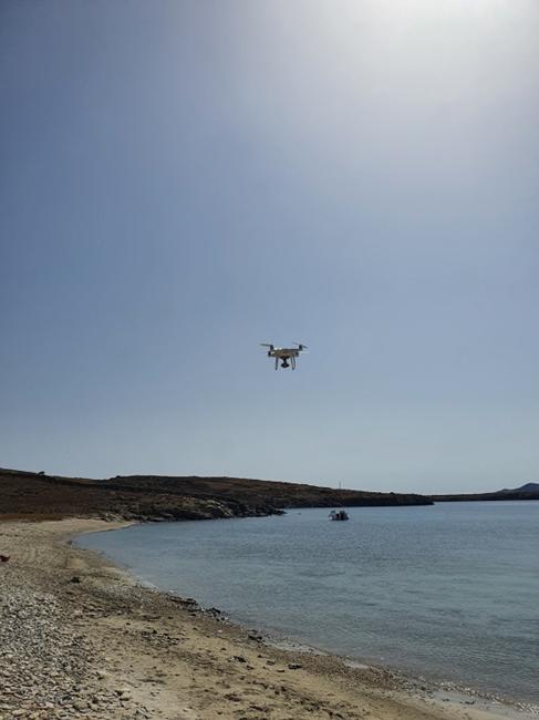
The Athanasios K. Laskaridis Foundation, faithful to the principles of sustainable development and the protection of the marine environment, joins forces with the Department of Marine Sciences of the University of the Aegean with the aim of the diachronic monitoring of plastic litter pollution in Rineia’s coastline. The pollution will be recorded using Unmanned Aerial Vehicle Systems (UAVs or drones) and will contribute to the feedback of the Coastal Marine Litter Observatory (CMLO) developed by the University of the Aegean. The analysis of aerial photographs will be done in a fully automated way by using artificial intelligence and cloud computing techniques. The results will be featured in an innovative online open-source Geographic Information System (GIS) with full access to the general public, created in collaboration with the company Geospatial Technologies (GET). The application generates density maps of plastic litter pollution in the coastal zone, allows the statistical analysis of time series data, and provides direct access to real data. The data collection will be done through a specialized protocol developed by the company SciDrones. Important for the development of the project is the expected role of local stakeholders who will participate in information, awareness, and technology transfer.
The innovative Spatio-temporal recording of plastic pollution in a place with minimal human intervention is expected to be the first documented observation of plastic pollution on a large scale in Greece. In addition, it is expected to contribute to the monitoring of plastic reduction policies in the European Union and provide a basis for reliable large-scale scientific Spatiotemporal observations.
Access to data: