
High Precision Survey of Ports
The constant technological evolution in Computer Vision and Unmanned Aerial Vehicles (UAVs), as well as the miniaturization of sensors, may lead to surveys with high-quality spatial information and products for several applications. The use of UAV systems for High Precision Survey of coastal areas is not only a flexible and attractive solution to produce accurate and high qualitative spatial data and geo visualizations but also is a significant contribution to cost effectiveness of monitoring. (more…)
Marine Spatial Planning
Cross-border Cooperation for Maritime Spatial Planning Development (Thal-Chor in Greek)
The strategic project “Cross-border Cooperation for Maritime Spatial Planning Development” was approved for funding under the Cross-border Cooperation Programme “Greece–Cyprus 2007–2013” on the 1st call for proposals for strategic projects, on July 2013. The project target was to develop a methodology for Marine Spatial Planning (MSP) and apply it in selected areas in Cyprus and Greece. The project was designed to prepare both countries for the imminent implementation of the EU Directive on MSP. (more…)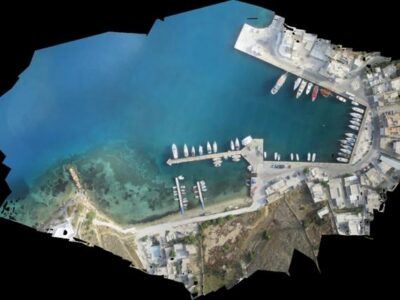
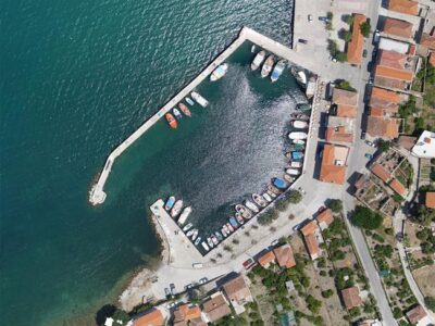
Costal Mapping
Developing methods and processes for data acquisition and mapping of the coastal environment.
Over the last decade, spatial analysis of satellite imagery has improved considerably, yet the information collected using satellite remote sensing is still insufficient for monitoring medium and small changes in the Earth's surface. The team uses Unmanned Aerial Systems (UAS) to collect remote sensing data, capable of capturing the complexity of coastal morphology in very high resolution for the creation of both two-dimensional and three-dimensional representations. (more…)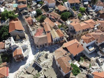
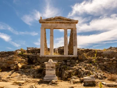
3D Mapping after earthquake
3D Mapping of the Vrissa region affected by the earthquake of Lesvos on 12/06/2017 Following the devastating earthquake of June 12, 2017, and the extraordinary conditions prevailing on the island of Lesvos the work of 3D mapping has been initiated in the affected area of the village of Vrissa. The project is being carried out by a specialized interdisciplinary research team from the University of the Aegean with the use of the appropriate technical equipment. (more…)

ARSx2 (AeRial System & Anti piRacy System)
In the framework of the Operational Programme Competitiveness, Entrepreneurship, and Innovation, participation in the scientific group for developing the project "(AeRial System and Anti piRacy System)" going by the acronym ARSx2. (more…)
Participation in AMOS project
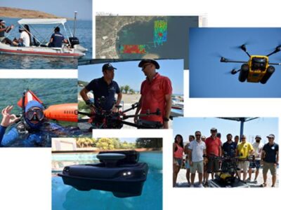
Geospatial Enabling Technologies (GET) in cooperation with the French SME SEMANTIC TS successfully completed between 5 and 10 of July in Lesvos island the pilot of the AMOS project "Shallow Water Aquatic Monitoring using Acoustic Sensors and Satellite Images" which is funded by the European Union’s NEPTUNE Horizon 2020 project. (more…)
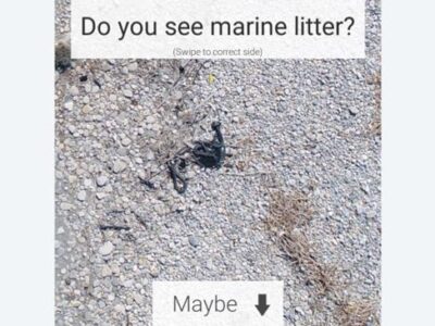
Collaboration with the IIASA team for marine litter tile sorting
The team has performed extensive surveys on coastal environments in Greece, gathering valuable information about marine plastic pollution using drones. This information needs to be further classified based on the presence and quantity of litter. (more…)
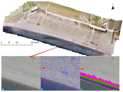
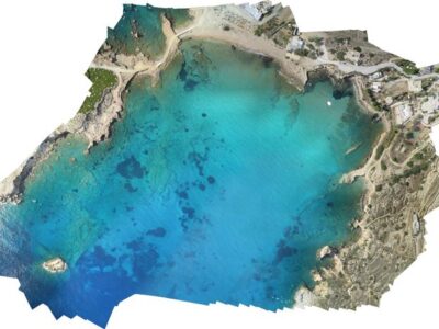
COASTAL Mapping in Lesvos Island
Researchers have developed specific methodologies for identifying coastline and coastal zones (coastal morphology). The availability of very high-resolution digital surface models (DSMs) and orthophoto maps is of increasing interest to all scientists, especially those monitoring small variations in the earth’s surface, such as coastline morphology. (more…)
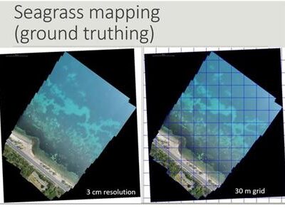
Seagrass mapping
The Common Fisheries Policy of EU requires mapping highly important habitats for fish production (e.g. underwater flowering meadows) in all EU Member States for the sustainable management of living aquatic resources and marine ecosystems. The Mediterranean region is under Regulation (1967/2006), and the fishing activities must be based on specific plans according to fishing zones which require knowledge on the distribution of underwater vegetation. In particular, the regions covered by marine angiosperm plants such as the endemic species of Mediterranean Posidonia oceanica (Posidonia), are areas of great ecological and economic interest for which mapping at the country level required a cost-effective and highly accurate methodologies. (more…)