2024-2027: ORIENTATE Project
ORIENTATE: DrOne sensors and immeRsive tEchNologies towards the Thematic MApping of SpaTiotemporal PhEnomena
Department of Civil Engineering and Geoinformatics of Cyprus University of Technology (€39,970). (more…)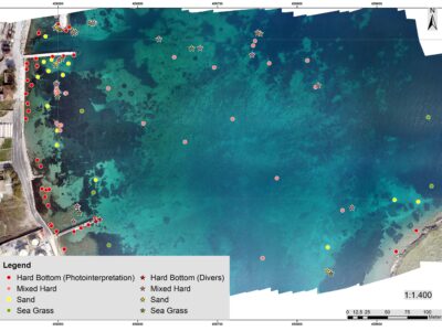
2024-2027: COASTLINE Project
COASTLINE: Coastal Zone Environment and Geo-Sciences
Department of Civil Engineering and Geoinformatics of Cyprus University of Technology (HORIZON-MSCA-2022-SE-01, €634,800).
(more…)
2024-2026: CONNECTING Project
CONNECTING: Research and Innovation Knowledge Centre for Engineering in Heritage
Department of Civil Engineering and Geoinformatics of Cyprus University of Technology (Research Infrastructures – Research and Innovation Foundation, €759,680). (more…)

2023-2026: ARGUS Project
ARGUS: Non-destructive, scalable, smart monitoring of remote cultural treasures
Department of Civil Engineering and Geoinformatics of Cyprus University of Technology (HORIZON-CL2-2023-HERITAGE-01, €3,996,147.5). (more…)
2023-2025: LC3 Project
LC3: Lemesos City Cooling Challenge
Department of Civil Engineering and Geoinformatics of Cyprus University of Technology (NetZeroCities Pilot Cities Programme, NZC-H2020-202209,€1,500,000). (more…)
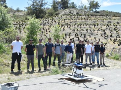
2022-2024 Oenowatch Project
Implementation of a Decision Support System using unmanned aerial systems (UAS) and establishment of a Competence Centre for innovative vine-growing to support the sustainable development of precision viticulture in Cyprus and maximize the national oenological potential. Project Number : “INTEGRATED/0918/0074”  (more…)
(more…)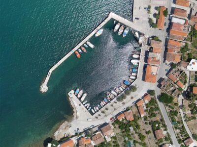
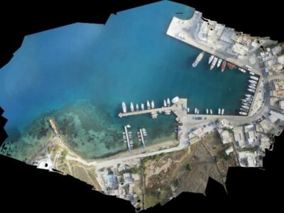
High Precision Survey of Ports
The constant technological evolution in Computer Vision and Unmanned Aerial Vehicles (UAVs), as well as the miniaturization of sensors, may lead to surveys with high-quality spatial information and products for several applications. The use of UAV systems for High Precision Survey of coastal areas is not only a flexible and attractive solution to produce accurate and high qualitative spatial data and geo visualizations but also is a significant contribution to cost effectiveness of monitoring. (more…)
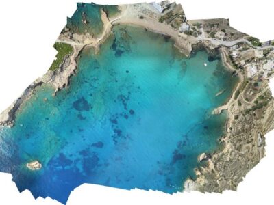
Marine Spatial Planning
Cross-border Cooperation for Maritime Spatial Planning Development (Thal-Chor in Greek)
The strategic project “Cross-border Cooperation for Maritime Spatial Planning Development” was approved for funding under the Cross-border Cooperation Programme “Greece–Cyprus 2007–2013” on the 1st call for proposals for strategic projects, on July 2013. The project target was to develop a methodology for Marine Spatial Planning (MSP) and apply it in selected areas in Cyprus and Greece. The project was designed to prepare both countries for the imminent implementation of the EU Directive on MSP. (more…)