Costal Mapping
Developing methods and processes for data acquisition and mapping of the coastal environment.
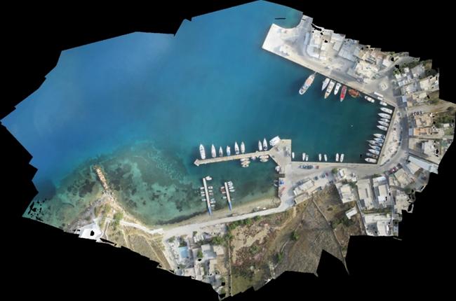
Over the last decade, spatial analysis of satellite imagery has improved considerably, yet the information collected using satellite remote sensing is still insufficient for monitoring medium and small changes in the Earth’s surface. The team uses Unmanned Aerial Systems (UAS) to collect remote sensing data, capable of capturing the complexity of coastal morphology in very high resolution for the creation of both two-dimensional and three-dimensional representations.
The use of unmanned aerial systems for spatial data acquisition has been continually increasing in recent years due to their advantages compared to traditional airborne and satellite methods. The team has the necessary equipment and scientific background in using UAS to acquire spatial data with high precision and to monitor spatiotemporal phenomena in the coastal zone. We use computer vision algorithms to produce geoinformation and geospatial products such as orthophotos with a spatial resolution of 3 to 10 cm and we compare those with traditional satellite images e.g. Sentinel-02 and Landsat-8.
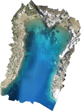
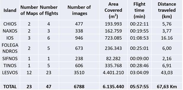
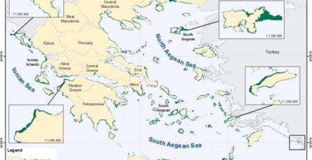
During last year’s fieldwork, the team carried out a collection of high-precision and very high-resolution remote sensing data in Greece. We created geospatial products for seven Aegean islands (i.e. Chios, Naxos, Ios, Folegandros, Sifnos, Tinos, and Lesvos) for more than 22 coastal areas. During the collection of spatial data, the group carried out autonomous flights lasting more than 5 hours of surveying (air time), collecting more than 6.000 high-resolution aerial photographs.
One of the largest collections of high-resolution geoinformation (orthophoto maps) for the Greek coastal zone was created for Greece to monitor the coastal environment.
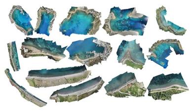
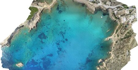
Some of the Group coastal zone monitoring surveys in the Greek Islands are the following.