Marine Spatial Planning
Cross-border Cooperation for Maritime Spatial Planning Development (Thal-Chor in Greek)
The strategic project “Cross-border Cooperation for Maritime Spatial Planning Development” was approved for funding under the Cross-border Cooperation Programme “Greece–Cyprus 2007–2013” on the 1st call for proposals for strategic projects, on July 2013. The project target was to develop a methodology for Marine Spatial Planning (MSP) and apply it in selected areas in Cyprus and Greece. The project was designed to prepare both countries for the imminent implementation of the EU Directive on MSP.
Thal-Chor
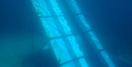
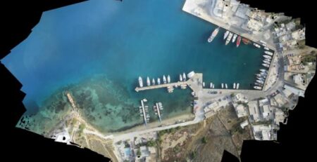
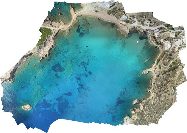
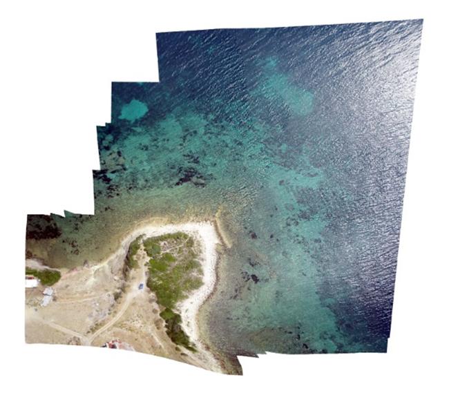
The was responsible for detecting seagrass meadows using satellite and UAV data. Seagrass meadows play an important role in ecosystems by stabilizing sediment and improving water clarity, which enhances seagrass growing conditions. The group used high-resolution satellite images WorldView-2 for seagrass mapping and orthophoto maps as ground truth data. Eight preselected areas in Lesvos island were mapped using IRIS+ drone and dedicated software. An example of our results can be seen in the following image.
Ground truth mosaic with 3cm spatial resolution derived from aerial UAV measurements.
MARISCA, ΜΑRItime Spatial planning for the protection and Conservation of the biodiversity in the Aegean sea, (EEA FM 2009-2014).

MARISCA stands for “MARIne Spatial Conservation planning in the Aegean sea” and is a project co-funded in 85% by the European Environmental Area Financial Mechanism, (EEA FM 2009-2014), and 15% by the Public Investments Programme (PIP) under the theme «Integrated Marine and Inland Water Management», “Increased knowledge concerning the integrated marine and islands policy or the protection / management of coastal areas”. The duration of the project is 13 months 01/12/2015 – 31/12/2016.
The project aims to contribute towards the protection and conservation of biodiversity in the context of an integrated Marine Spatial Plan (MSP) in the Aegean Sea. A network of Marine Protected Areas (MPAs) and protection zones will be proposed for the conservation of all-important and vulnerable habitats and species, as defined by national and community legislation and international agreements. The study area covers the coastal and marine ecosystems of the Aegean Sea, Greece.
The project consortium is composed of three partners (University of the Aegean, Hellenic Centre for Marine Research (HCMR) and the Institute of Marine Research (IMR) from 2 countries (Greece and Norway) coordinated by the University of the Aegean based in Lesvos island, Greece. The project coordinator is Associate Professor Stelios Katsanevakis.