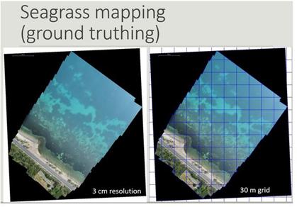
Seagrass mapping
The Common Fisheries Policy of EU requires mapping highly important habitats for fish production (e.g. underwater flowering meadows) in all EU Member States for the sustainable management of living aquatic resources and marine ecosystems. The Mediterranean region is under Regulation (1967/2006), and the fishing activities must be based on specific plans according to fishing zones which require knowledge on the distribution of underwater vegetation. In particular, the regions covered by marine angiosperm plants such as the endemic species of Mediterranean Posidonia oceanica (Posidonia), are areas of great ecological and economic interest for which mapping at the country level required a cost-effective and highly accurate methodologies.
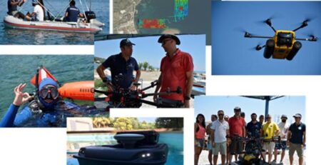
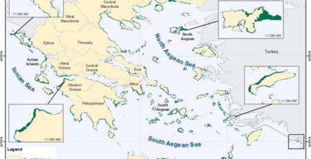
We have been specialized in seagrass mapping by satellite images and aerial orthophoto maps in several spatial scales. The team (MRSG) has recently mapped the seagrass on country scale (Greece) using object-based analysis on Landsat-8 OLI images (spatial resolution 30 m). In specific areas, the fine spatial resolution of 2-4 m (i.e. Ikonos, WorldView-2) used for ground truthing and accuracy analysis. Drones are used to map in the extreme spatial scale of 0.03 m (3 cm). The team is able to inter-compare the different spatial scales and calculate the percentage coverage of seagrasses on a specific pixel. Also, the seagrass deep limit identification is under investigation using drop cameras, echo sounders and ROV in situ measurements.
Projects
- MARISCA, ΜΑRItime Spatial planning for the protection and Conservation of the biodiversity in the Aegean sea, (EEA FM 2009-2014).
- Underwater seagrass meadows detection, classification and mapping in satellite images, National Funding