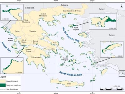
Seagrass mapping in Greek territorial waters using Landat-8 satellite images
Seagrass meadows are among the most valuable coastal ecosystems on earth due to their structural and functional roles in the coastal environment. This study demonstrates remote sensing’s capacity to produce seagrass distribution maps on a regional scale. The seagrass coverage maps provided here describe and quantify for the first time the extent and the spatial distribution of seagrass meadows in Greek waters. (more…)